Agricultural Drone vs Ground Sensor Cost Analysis 2026:…

SOLAR TODO
Solar Energy & Infrastructure Expert Team
Watch the video
TL;DR
In 2026, agricultural drones are usually the better choice for fast scouting across 100-400 hectares per day, while ground sensor networks are better for continuous 10-minute monitoring, threshold alerts, and automated control on 10-50 hectare blocks. For orchards, tea estates, and water-stressed farms, the strongest ROI often comes from a hybrid model that combines drone mapping with fixed LoRaWAN or 4G sensing.
Agricultural drones cover 100-400 ha/day, while fixed ground sensor networks monitor 10-50 ha continuously at 10-minute intervals; 2026 project economics show drones often cost $6-25/ha per flight, versus sensor networks reaching 3-6 year payback through irrigation, frost, and disease-loss reduction.
Summary
Agricultural drones cover 100-400 ha/day, while fixed ground sensor networks monitor 10-50 ha continuously at 10-minute intervals; 2026 project economics show drones often cost $6-25/ha per flight, versus sensor networks reaching 3-6 year payback through irrigation, frost, and disease-loss reduction.
Key Takeaways
- Compare drones and ground sensors by decision cycle: use drones for 100-400 ha/day scouting and sensors for 24/7 data at 10-minute intervals.
- Budget drone data collection at roughly $6-25/ha per mission in 2026, while fixed LoRaWAN sensor systems often spread CAPEX over 3-6 years.
- Select ground sensors when threshold alerts matter, because frost or irrigation events can change within 1-3 hours and require always-on measurement.
- Use drones for spatial variability mapping, since multispectral flights can identify canopy differences across 5-10 cm/pixel imagery over large blocks.
- Combine both tools when managing 30-50 ha or more, because hybrid workflows often improve irrigation timing by 10-30% and reduce scouting labor.
- Check communications and power design before purchase: LoRaWAN nodes commonly support 2-15 km links, and solar-powered nodes reduce field battery visits.
- Evaluate data quality by agronomic purpose: drone NDVI maps are periodic snapshots, while in-soil probes measure root-zone moisture and temperature directly.
- Request EPC pricing in three tiers—FOB, CIF, and turnkey—and target volume discounts of 5% at 50+ units, 10% at 100+, and 15% at 250+.
Market Context and 2026 Decision Framework
Agricultural drone programs typically deliver high-resolution coverage across 100-400 hectares per day, while ground sensor networks provide 24/7 field measurements every 10 minutes across 10-50 hectare blocks with lower recurring survey cost.
The 2026 buying decision is no longer about which tool is better in general. It is about which tool answers a specific agronomic question at the right time and cost. A drone can scan a 200 ha block in a single day and produce 5-10 cm imagery, but it cannot measure root-zone moisture continuously at 20 cm or 40 cm depth between flights. A sensor node can do that every 10 minutes, yet it cannot show full-canopy variability across hundreds of hectares in one pass.
According to the International Energy Agency, "digitalization and data are becoming central to energy and resource efficiency across sectors," and agriculture is following the same pattern with sensor-driven control and remote monitoring. According to FAO and precision-agriculture studies cited across the sector, irrigation and disease response timing can shift yield outcomes by 10-25% in water-stressed or disease-prone crops. For B2B buyers, that means the cost metric should be tied to prevented loss, not device price alone.
For procurement managers, the practical comparison has four filters: coverage area, data frequency, actionability, and total cost of ownership. Drones are often better for weekly or event-based scouting over 50-500 ha. Ground sensors are stronger for threshold-based control, such as frost alerts near 0°C to -2.5°C, irrigation automation, or disease-risk modeling based on humidity and leaf-wetness proxies. SOLAR TODO typically sees the strongest business case when buyers map large-area variability by drone and control field operations through fixed sensors.
2026 cost structure snapshot
According to industry pricing benchmarks from 2024-2026 procurement rounds, agricultural drone service pricing commonly falls between $6/ha and $25/ha depending on sensor payload, regulatory requirements, and processing depth. Ground sensor systems vary more by density, but a professional LoRaWAN deployment for 30-50 ha often includes 10-20 sensing points, 1-2 gateways, solar-powered nodes, and cloud software under a multi-year CAPEX model.
| Metric | Agricultural Drone | Ground Sensor Network |
|---|---|---|
| Typical coverage rate | 100-400 ha/day | 10-50 ha per network block |
| Data frequency | Per flight | Every 10 minutes typical |
| Spatial resolution | 2-10 cm/pixel | Point-based, root-zone direct |
| Typical cost basis | $6-25/ha per mission | CAPEX + cloud + maintenance |
| Best use | Mapping variability | Continuous alerts and control |
| Weakness | No continuous data | Limited spatial interpolation |
Coverage, Data Quality, and Agronomic Fit
Drone imagery gives broad spatial visibility at 2-10 cm resolution, while ground sensors provide direct root-zone and microclimate measurements every 10 minutes, making each tool accurate for different decisions rather than interchangeable.
Coverage is the first major difference. A multispectral drone can map canopy vigor, stand gaps, drainage patterns, and stress zones across 100-400 ha/day, depending on flight altitude, battery swaps, and local aviation rules. That broad view is useful for tea, orchard, row crop, and desert reclamation projects where field variability changes across slope, soil texture, or irrigation pressure. However, drone data is episodic. If the field is flown once every 7 days, six days of moisture or frost dynamics remain unobserved.
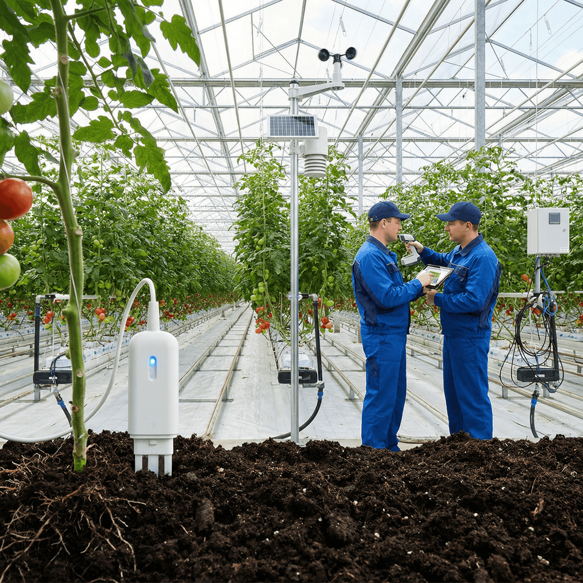
Ground sensors trade spatial breadth for temporal depth. A weather station can measure 8-10 atmospheric parameters, while soil probes can track 2-7 parameters at multiple depths. In orchard frost management, a 1-3 hour temperature drop can determine whether wind machines, irrigation, or other protection should start. In that case, a drone flight after sunrise documents damage or stress patterns, but it does not provide the alert needed at 03:00.
According to WMO guidance, weather observations are most useful when collected consistently with known siting and interval rules. That matters because data quality is not only about sensor precision. It is also about continuity, calibration, and whether the measurement is directly tied to the agronomic action. A 5 cm/pixel NDVI map can indicate a weak zone. A soil probe at 20 cm and 40 cm can confirm whether the weak zone is caused by water deficit, salinity trend, or root-zone temperature.
Data quality by use case
For disease management, drones and sensors measure different proxies. Multispectral or thermal drone payloads can detect canopy stress before visible symptoms in some crops, especially when flown at 5-10 cm resolution under repeatable light conditions. Ground networks are stronger for disease-risk modeling from humidity, temperature, rainfall, leaf-wetness proxy, and soil conditions measured every 10 minutes. Tea estates and orchards often need both: broad hotspot detection and continuous risk tracking.
| Agronomic task | Better tool | Why | Typical data interval |
|---|---|---|---|
| Irrigation scheduling | Ground sensors | Direct soil moisture at root depth | 10 min |
| Frost early warning | Ground sensors | Real-time threshold alerts | 10 min |
| Nutrient/stress zoning | Drone | Full-field spatial map | Weekly/event-based |
| Drainage pattern mapping | Drone | High-area visual and multispectral coverage | Weekly/monthly |
| Disease hotspot scouting | Drone + sensors | Stress map plus weather-risk context | Hybrid |
| Automated control | Ground sensors | Connects to pumps, valves, wind machines | Continuous |
Cost Analysis: CAPEX, OPEX, and ROI by Farm Model
In 2026, drones usually win on low-entry scouting cost for large areas, while ground sensors often win on 3-6 year ROI when irrigation, frost, or disease decisions depend on continuous measurement and automated response.
The most common budgeting mistake is comparing a drone mission price to a sensor hardware quote without matching the agronomic outcome. A drone priced at $12/ha may appear cheaper than a sensor deployment if the buyer only looks at first-year cash outlay. But if the operation needs 20 flights per season over 200 ha, annual service cost can reach $48,000 before advanced analytics. A fixed network may carry higher first-year CAPEX yet lower recurring measurement cost over 36-72 months.
Sample deployment scenario (illustrative): a 40 ha orchard with 10 sensing points, 1 weather station, 1 gateway, solar-powered nodes, and professional cloud monitoring can support frost and irrigation decisions continuously. If that system prevents even 5-10% crop loss during one frost event or reduces irrigation water use by 10-20%, the payback can compress materially. According to sector studies and vendor benchmark data, precision irrigation can reduce water use by up to 20-50% depending on crop, baseline practice, and automation level.
Drone economics improve when the farm has 200 ha or more, scattered blocks, or a need for periodic compliance records and visual scouting. Ground sensor economics improve when each missed event is expensive. Apple, citrus, tea, and desert reclamation sites often fit the second profile because microclimate and root-zone conditions move faster than manual inspection cycles.
ROI comparison table
| Farm/application | Drone-first model | Sensor-first model | Typical payback driver |
|---|---|---|---|
| Orchard frost, 40 ha | Moderate ROI | Strong ROI | Avoid 5-20% event loss |
| Tea garden, 30 ha | Strong for disease scouting | Strong for irrigation + disease risk | Yield quality + timing |
| Desert reclamation, 50 ha | Moderate for mapping | Very strong for water control | 15-50% water savings |
| Broadacre scouting, 300 ha | Strong ROI | Selective ROI | Labor reduction + zoning |
| Greenhouse/permanent crop | Limited | Strong ROI | Continuous climate control |
Year-over-year trend analysis, 2022-2040
According to IRENA (2024), digitalized renewable and off-grid systems continue to reduce the cost of remote monitoring infrastructure, especially where solar-powered nodes replace frequent battery service. According to NREL and broader ag-tech market tracking, sensor costs have fallen gradually from 2022 to 2026, while analytics and cloud subscriptions remain a larger share of lifecycle cost.
From 2022 to 2024, many farms adopted drones first because service-based models reduced entry barriers. In 2025-2026, procurement is shifting toward hybrid systems because buyers want both spatial maps and automated alerts. From 2027 to 2030, expect denser AI-assisted anomaly detection, more 4G/5G backhaul in remote farms, and lower-cost edge processing. From 2030 to 2040, the likely scenario is not drone versus sensor, but drone plus sensor plus control layer, with autonomous irrigation and frost response becoming standard on higher-value crops.
| Period | Drone trend | Ground sensor trend | Likely buyer behavior |
|---|---|---|---|
| 2022-2024 | Fast adoption for scouting | Moderate adoption | Pilot projects |
| 2025-2026 | Better analytics and thermal payloads | Lower node cost, wider LoRaWAN use | Hybrid procurement |
| 2027-2030 | More automation in flight planning | More edge AI and control logic | Integrated platforms |
| 2030-2040 | Autonomous scouting fleets | Dense field digital twins | Outcome-based contracts |
Regional Cost and Deployment Differences
Asia-Pacific, Europe, North America, Middle East/Africa, and Latin America show different economics because labor rates, farm size, connectivity, and water stress can shift ROI by 20-40% even with similar hardware.
Asia-Pacific often favors mixed deployments because tea, orchard, horticulture, and fragmented field layouts benefit from both broad scouting and dense microclimate data. In Southeast Asia, 30 ha tea or orchard blocks with elevation changes of 10-500 m often justify fixed weather and soil networks due to rapid local variability. Europe tends to place higher value on traceability, environmental reporting, and compliance-grade records, which can support both drone imagery archives and calibrated sensor logs.
North America generally offers stronger drone economics on larger contiguous farms, especially above 200 ha, where labor reduction and rapid scouting matter. Middle East/Africa often shows stronger sensor ROI where evapotranspiration can exceed 5-10 mm/day and grid reliability is weak, making solar-powered nodes and automated irrigation especially valuable. Latin America can support both models, but logistics and terrain often favor LoRaWAN networks for permanent crops and drones for large-area plantation surveys.
According to IEA (2024), digital infrastructure and electrification quality remain uneven across regions, which directly affects remote monitoring architecture. SOLAR TODO addresses this by offering LoRaWAN and 4G LTE options, solar-powered outdoor nodes, and professional cloud tiers matched to field conditions rather than assuming stable grid and fiber access.
| Region | Drone cost tendency | Sensor ROI tendency | Main driver |
|---|---|---|---|
| Asia-Pacific | Medium | High | Microclimate variability |
| Europe | Medium-high | High | Compliance + quality records |
| North America | Low-medium on large farms | Medium-high | Scale + labor savings |
| Middle East/Africa | Medium | Very high | Water stress + off-grid need |
| Latin America | Medium | High | Terrain + permanent crops |
EPC Investment Analysis and Pricing Structure
For 2026 smart agriculture projects, EPC-style delivery reduces integration risk by bundling hardware, communications, commissioning, and training into one scope, with pricing typically split into FOB Supply, CIF Delivered, and EPC Turnkey tiers.
For B2B buyers, EPC means more than installation. It usually includes site survey, bill of materials, weather station and soil probe selection, gateway and power design, cloud onboarding, commissioning, dashboard setup, and operator training. For projects above 30 ha, this matters because sensor density, mast siting, solar power sizing, and communications path loss can determine whether the system works reliably through a full season.
A practical three-tier structure is:
- FOB Supply: hardware only, ex-factory pricing for buyers with local installers.
- CIF Delivered: hardware plus freight and insurance to destination port.
- EPC Turnkey: delivered system plus installation, commissioning, testing, and training.
Volume pricing guidance for standard hardware packages typically follows:
- 50+ units: about 5% discount
- 100+ units: about 10% discount
- 250+ units: about 15% discount
Typical payment terms are:
- 30% T/T deposit + 70% against B/L
- 100% L/C at sight for qualified orders
Financing is available for larger projects above $1,000K, subject to project profile, country risk, and buyer qualification. For pricing, EPC scope, and warranty terms, buyers can contact [email protected] or reach SOLAR TODO at +6585559114 for offline quotation support.
Product fit within SOLAR TODO smart agriculture portfolio
SOLAR TODO offers smart agriculture systems that show where fixed sensing outperforms periodic aerial surveys. The Orchard Frost Early Warning 40ha package covers 40 hectares with 10 field sensing points, LoRaWAN communication, solar-powered nodes, and 10-minute intervals, which is directly aligned with frost events that can damage crops within 1-3 hours. The Tea Garden Precision Monitoring 30ha package adds AI-based leaf disease detection across 30 ha with 15 sensors/devices. The Desert Reclamation Solar+Agriculture 50ha package combines 500 kW solar PV, 20 sensors, 4G LTE, weather monitoring, 7-parameter soil analysis, and automated drip-irrigation control for 50 ha.
FAQ
A practical 2026 answer is that drones are better for 100-400 ha/day scouting, while ground sensors are better for 24/7 monitoring at 10-minute intervals and automated action.
Q: What is the main cost difference between agricultural drones and ground sensors in 2026? A: Drones usually have lower entry cost because you can buy a service per mission, often around $6-25/ha depending on payload and analytics. Ground sensors usually require higher upfront CAPEX for nodes, gateways, and cloud setup, but the cost is spread over 3-6 years and can produce stronger ROI where continuous alerts prevent losses.
Q: Which option gives better coverage for large farms? A: Drones give better spatial coverage for large farms because one flight program can scan 100-400 ha/day and produce 2-10 cm imagery. Ground sensors cover smaller blocks, commonly 10-50 ha per network, but they monitor those blocks continuously and can support direct irrigation or frost control.
Q: Which option provides better data quality for irrigation decisions? A: Ground sensors usually provide better irrigation data because they measure soil moisture and temperature directly at root depth every 10 minutes. Drone imagery can show stress patterns across the field, but it does not replace in-soil measurements at 20 cm or 40 cm when the goal is valve timing or pump automation.
Q: Are drones enough for frost protection in orchards? A: No, drones alone are usually not enough for frost protection because frost damage can develop within 1-3 hours during the night. Orchard operators need continuous air temperature, humidity, and wind data with alerts near 0°C to -2.5°C, which fixed sensor networks can provide in real time.
Q: When does a hybrid drone-plus-sensor system make the most sense? A: A hybrid system makes the most sense when the farm is 30-50 ha or larger and both spatial variability and real-time control matter. Typical examples include orchards, tea gardens, and desert reclamation sites where drones locate hotspots and sensors confirm moisture, weather, or disease-risk conditions before action is taken.
Q: What communications architecture is common for ground sensor systems? A: LoRaWAN is common for 10-50 ha agricultural monitoring because it can support low-power nodes over roughly 2-15 km depending on terrain and antenna height. 4G LTE is often added for backhaul or for larger remote sites, especially where cloud reporting and automated control need wider-area connectivity.
Q: How do maintenance requirements compare? A: Drones need battery management, pilot compliance, payload calibration, and weather-dependent flight scheduling, so operating discipline is important every season. Ground sensors need periodic probe checks, mast inspection, cleaning, and calibration review, but solar-powered nodes can reduce routine battery replacement visits in remote fields.
Q: What should buyers ask about EPC pricing and warranty? A: Buyers should ask whether the quote is FOB Supply, CIF Delivered, or EPC Turnkey, because installation and commissioning can materially change total cost. They should also confirm warranty scope for weather stations, probes, gateways, and cloud service duration; financing may be available for projects above $1,000K through SOLAR TODO.
Q: Which option is better for disease monitoring in tea or horticulture? A: Drones are better for spotting canopy hotspots over large areas, especially with multispectral imagery at 5-10 cm resolution. Ground sensors are better for disease-risk timing because temperature, humidity, rainfall, and soil conditions can be logged every 10 minutes, which supports earlier intervention and more consistent spray planning.
Q: How should procurement teams compare total cost of ownership? A: Procurement teams should compare total seasonal missions, software fees, labor, maintenance, and avoided-loss value, not only hardware price. A drone model may look cheaper at first, but repeated flights over 200 ha can exceed the lifecycle cost of a fixed network if the site needs constant monitoring for irrigation, frost, or water quality.
References
A practical source base for this topic includes IEA, IRENA, NREL, WMO, ISO, and major market analysts because cost, coverage, and data quality depend on both agronomy and infrastructure standards.
- International Energy Agency (IEA) (2024): World Energy Outlook and digitalization commentary relevant to remote monitoring, electrification, and data-driven resource efficiency.
- International Renewable Energy Agency (IRENA) (2024): Renewable Capacity Statistics and cost trend publications relevant to solar-powered field infrastructure and remote energy systems.
- National Renewable Energy Laboratory (NREL) (2024): PVWatts and distributed energy performance methods relevant to sizing solar-powered sensor nodes and off-grid monitoring systems.
- World Meteorological Organization (WMO) (2023): Weather observation guidance relevant to siting, interval consistency, and measurement quality for agricultural weather stations.
- ISO 11783 (latest applicable edition): Agricultural electronics and data interoperability standard relevant to connected farm data exchange.
- BloombergNEF (2024): Clean technology cost and financing benchmark reports relevant to equipment bankability and project economics.
- Wood Mackenzie (2024): Energy and infrastructure market analysis relevant to communications, power systems, and project cost benchmarking.
- FAO (2023): Digital agriculture and irrigation efficiency guidance relevant to water productivity and farm decision support.
Conclusion
For 2026 farm operations, drones are the better tool for 100-400 ha/day spatial scouting, while ground sensors are the better tool for 10-minute monitoring, threshold alerts, and automated control across 10-50 ha blocks.
The bottom line is simple: if the cost of a missed event is high, fixed sensors usually deliver the stronger ROI; if the cost of poor field visibility is high, drones add value quickly. For many orchards, tea estates, and desert reclamation projects, SOLAR TODO recommends a hybrid design that combines periodic aerial mapping with continuous LoRaWAN or 4G field sensing.
About SOLARTODO
SOLARTODO is a global integrated solution provider specializing in solar power generation systems, energy-storage products, smart street-lighting and solar street-lighting, intelligent security & IoT linkage systems, power transmission towers, telecom communication towers, and smart-agriculture solutions for worldwide B2B customers.
About the Author

SOLAR TODO
Solar Energy & Infrastructure Expert Team
SOLAR TODO is a professional supplier of solar energy, energy storage, smart lighting, smart agriculture, security systems, communication towers, and power tower equipment.
Our technical team has over 15 years of experience in renewable energy and infrastructure, providing high-quality products and solutions to B2B customers worldwide.
Expertise: PV system design, energy storage optimization, smart lighting integration, smart agriculture monitoring, security system integration, communication and power tower supply.
Cite This Article
SOLAR TODO. (2026). Agricultural Drone vs Ground Sensor Cost Analysis 2026:…. SOLAR TODO. Retrieved from https://solartodo.com/knowledge/agricultural-drone-vs-ground-sensor-cost-analysis-2026-coverage-data-quality
@article{solartodo_agricultural_drone_vs_ground_sensor_cost_analysis_2026_coverage_data_quality,
  title = {Agricultural Drone vs Ground Sensor Cost Analysis 2026:…},
  author = {SOLAR TODO},
  journal = {SOLAR TODO Knowledge Base},
  year = {2026},
  url = {https://solartodo.com/knowledge/agricultural-drone-vs-ground-sensor-cost-analysis-2026-coverage-data-quality},
  note = {Accessed: 2026-05-26}
}
Published: May 26, 2026 | Available at: https://solartodo.com/knowledge/agricultural-drone-vs-ground-sensor-cost-analysis-2026-coverage-data-quality
Subscribe to Our Newsletter
Get the latest solar energy news and insights delivered to your inbox.
View All Articles